Combrignac
Natural, Walking
in Champagnac-la-Noaille
6.1
km
on foot
2h
Medium
-
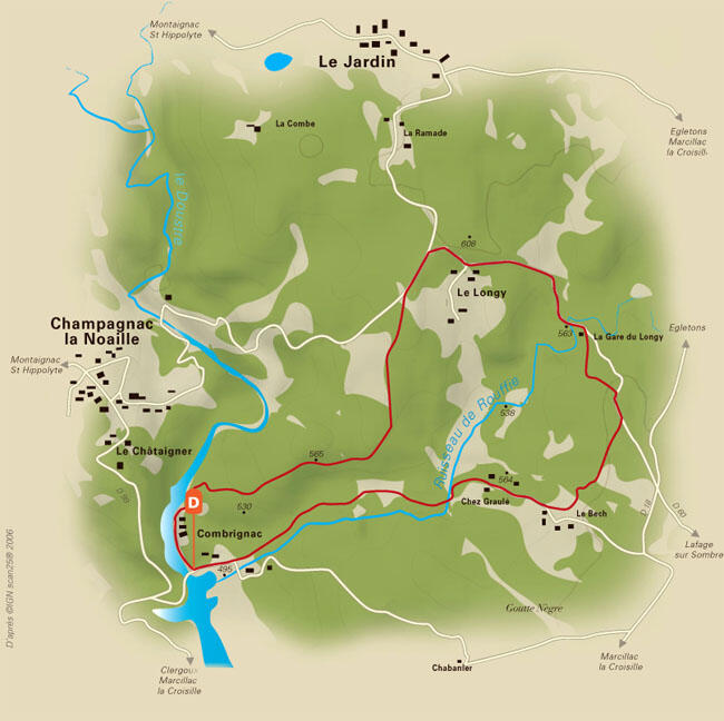
Combrignac, landing stage for pike fishing or starting point for walkers, its paved paths lead you to the hills and plateaus of the Doustre. On the Rouffie stream, a very discreet mammal leaves its epreinte on leaving the water. Made up of fish scales and bones and with a characteristic musk, this trace reveals the presence of the otter.
- Departure
- Champagnac-la-Noaille
-
-
Difference in height
- 166.333 m
-
-
-
Documentation
- GPX / KML files allow you to export the trail of your hike to your GPS (or other navigation tool)
-
- See all reviews
- 166 meters of difference in height
-
- Maximum altitude : 610 m
- Minimum altitude : 491 m
- Total positive elevation : 166 m
- Total negative elevation : -166 m
- Max positive elevation : 63 m
- Min positive elevation : -45 m