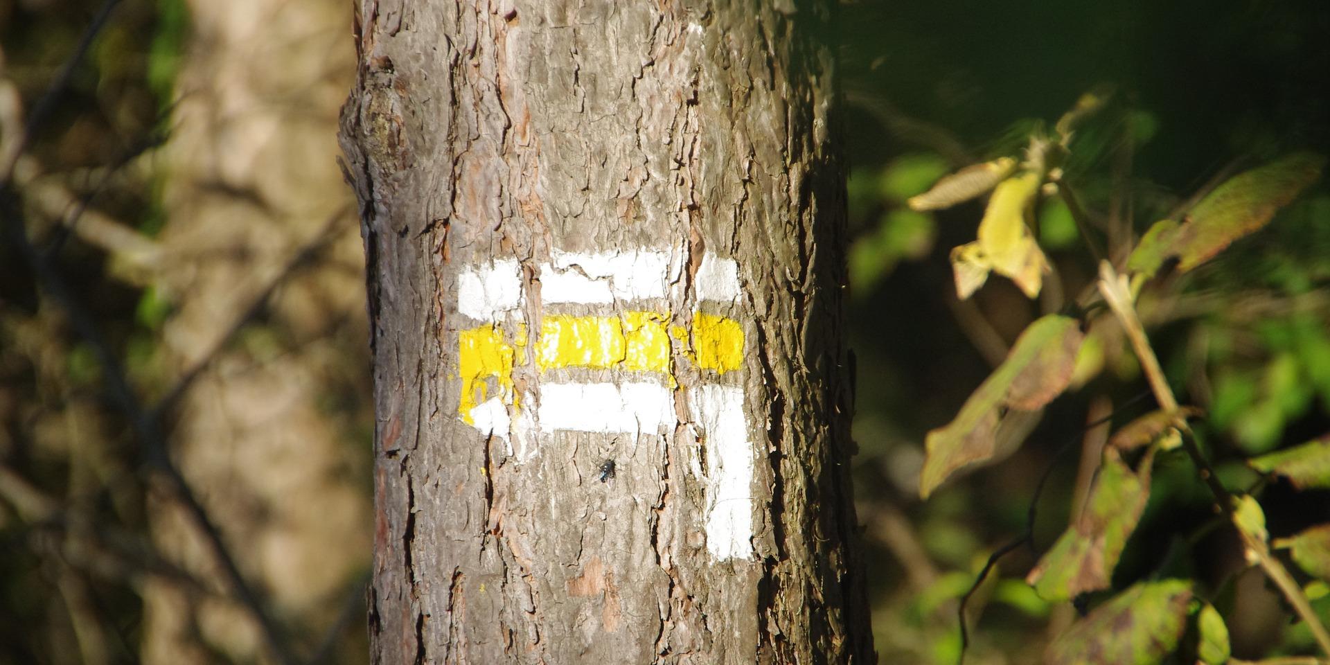
Before going on a hike, it is important to know the trails you walk on and the markings that allow you to stay on the right path. A brief summary of this essential information for all hikers :
Hiking routes
There are 3 main categories of hiking routes :
- The “Great Hiking® routes” (Grande Randonnée® in French), making it possible to cross in a touring hike a region, a country, …
The “Great Country Hiking Routes ®” (Grande Randonnée de Pays ® in French), itineraries or route networks designed for the most part in loops and which make it possible to discover specific landscape entities.
The PR walks (Itinéraires de Promenade et Randonnée in French), on a loop or on a round-trip and for less than a day..
Hiking routes’ markups
The marking of hiking routes allows you to follow the path correctly, from its point of departure to its point of arrival. Depending on the type of route you take, the markup will be different :
For the “Great Hiking® routes” : they are recognizable by their beacons with white and red colors
For the “Great Country Hiking Routes ®” : they are recognizable by their tags with red and yellow colors.
For PR walks: these routes are recognizable by their yellow tags. Warning: some circuits still have markings of different colors (blue, red, …).
Meanwhile, the shape of the beacons show you the way to follow:
Two horizontal rectangles (for the case of PR, it’s a single rectangle) : you’re on the right track.
A straight arrow pointing to the left or the right surmounted by two lines (one in the case of PR) : you must change direction by following the bottom arrow, which indicates the direction of the route.
A two-rectangles cross: you are in the wrong direction.
Specific markups of ATV’s routes
The shape of the marking of the mountain bike circuits is different from that of the pedestrian circuits. The mountain bike routes are marked by two rounds contiguous to an equilateral triangle of color, which color differs according to the length of the route :
Red for itineraries over 80 kilometers and Great Traversées
Yellow for local routes
Brown for local routes of the Regional Natural Parks.
Depending on the degree of difficulty of the ATV trail, a number on the tag is entered.
Specific markups of equestrian hiking routes
The equestrian routes are marked with an orange rectangle.


